From my field notes: Homonhon and Ginsaugon
One of the things that I like about my job as a government geologist, despite the meager salary I receive everymonth, is that I get to visit places I will have no chance of seeing in my lifetime if I were, say, employed as a banker.
A. Homonhon Island
Every Filipino grade schooler knows Homonhon Island. It's the bean-shaped landmass south of Eastern Samar facing the Pacific Ocean where the Spanish (actually Portuguese) Magellan and his men first set foot on the Philippine soil after almost two years of travel from Europe.
Although it is an important landmark in the Philippine history, but because of its location, I never imagined I would be able to set foot on the island.
So eat your heart out, Yoyoy Villame! I have been to the island you have immortalized in your Philippine Geography song, not only once but thrice in the last two years!
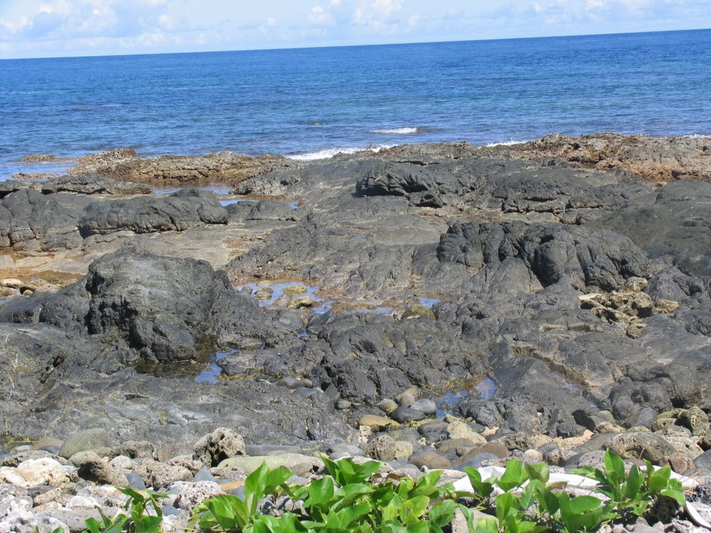 This is very shore where Magellan and his fleet of five ships landed five hundred years ago (March 16, 1521).
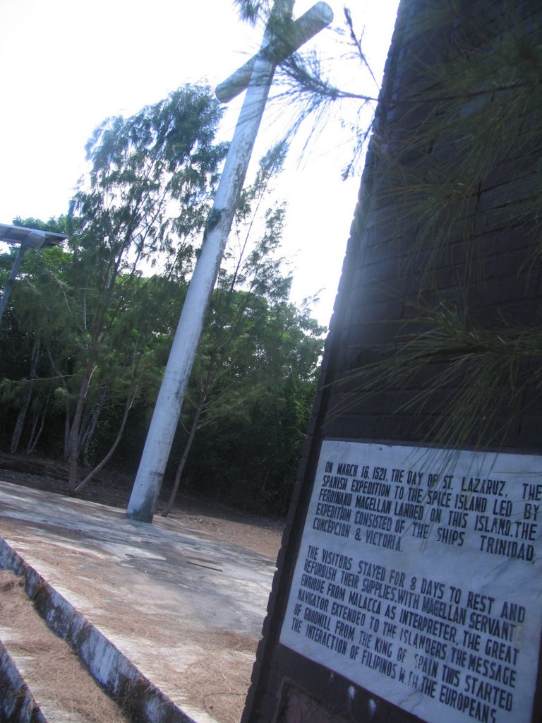 A cross and a mural with a plaque marking the site where Magellan and his men took rest after reaching the Philippine soil.
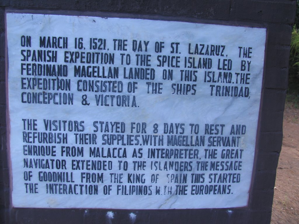 A plaque commemorating Magellan's landing on the Philippine shore.
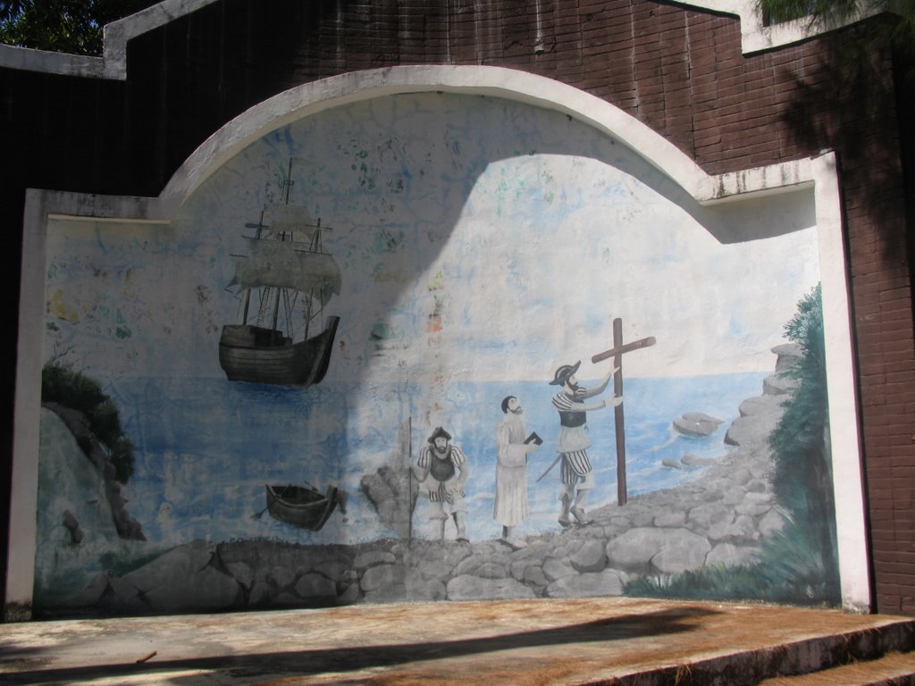 An artist's depiction of Magellan and his men reaching Homonhon.
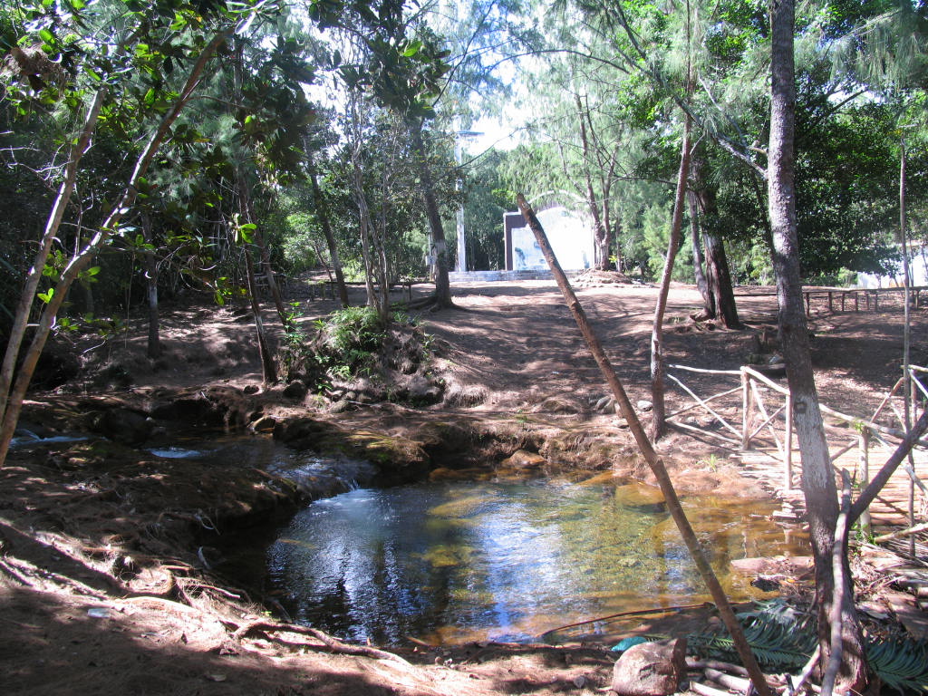 This creek runs for about 100 meters before emptying into the sea. Magellan and his men followed the creek from the shore until they reached this place where they replenished their water supplies. At the background is the mural and the cross where Magellan and his men took rest for 8 days.
B. Ginsaugon
Ginsaugon. I have been to this place two years ago. I rented a habal-habal and followed the trace of the Philippine Fault which passes near the Ginsaugon village.
When I reached the place again early this month, I was dumbfounded by what I saw. What used to be a lively village is now but a desolate heap of rocks and white boulders. I felt sad knowing that under the place where I stood were villagers, numbering to around a thousand, including two hundred school children, buried under 30-meter debris.
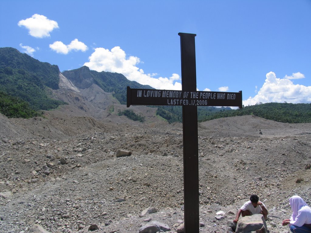 A cross was constructed to remember those who were buried under tons of debris.
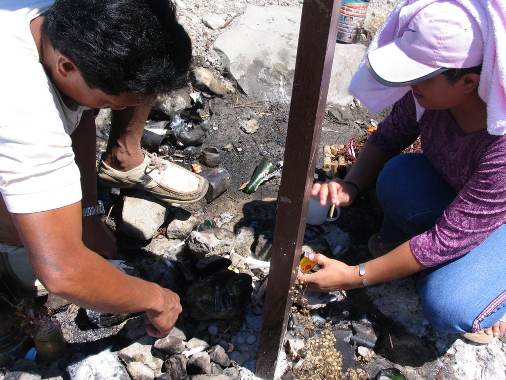 I came across two former Ginsaugon residents who were there to light candles for their love ones: a man who lost his entire family and a lady who lost her mother, daughter and two nephews.
Teary-eyed, the man described to me how he and three others saw in horror, from a safe higher ground where they were tending their farms, the tons of debris that engulfed the whole village, his two school age kids and wife included- in less than two minutes. He and his three companions could only cry in despair.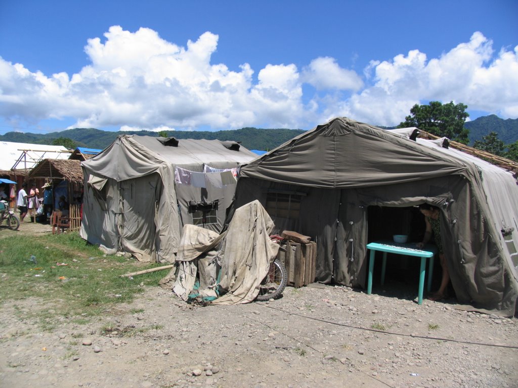 Tent city- this is where the landslide victims are housed.
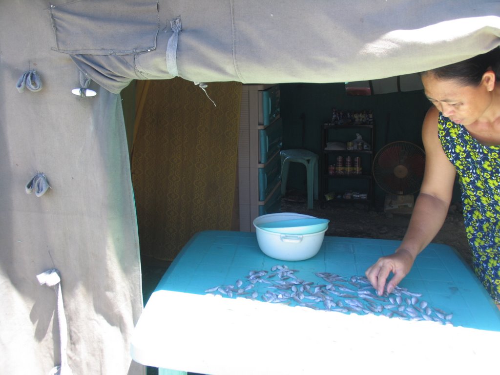 Business as usual for this lady tending her sari-sari store inside the evacuation center.
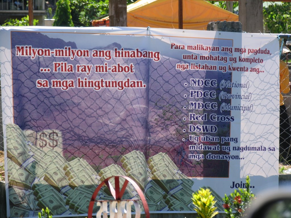 It's also business as usual for the usual suspects. The streamer reads... " Millions of donations, but only a fraction reached the intended victims...the following government agencies... to erase all doubts, should explain and provide a detailed accounting for the donations." SHAME!
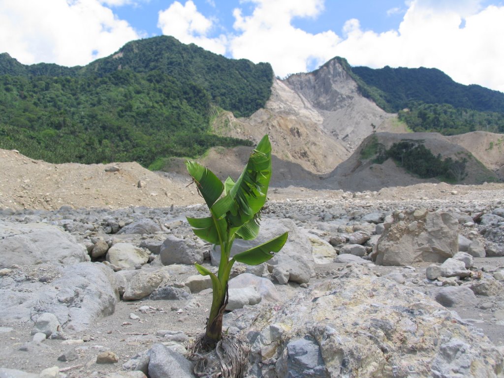 Sisibol pa sana ang magandang umaga para sa mga taga Ginsaugon.
posted by Taong Bato @ 3:14 AM
1 comments
![]()
